

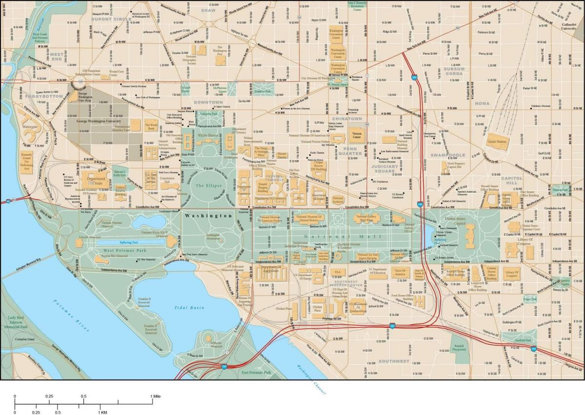
You can find on this page the Washington DC streets map to print and to download in PDF. The Washington DC roads map presents the road network, main roads, routes and motorways of Washington DC in USA.
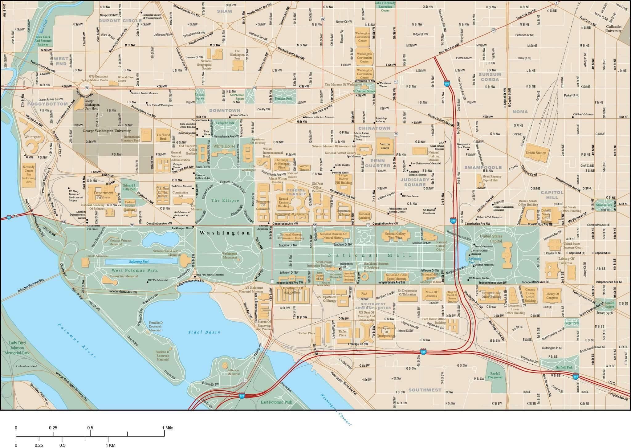
The Washington DC streets map shows all street network and main roads of Washington DC. This streets map of Washington DC will allow you to find your routes through the streets of Washington DC in USA. The Washington DC streets map is downloadable in PDF, printable and free.
Washington DC streets was bordered by Boundary Street to the north (renamed Florida Avenue in 1890), Rock Creek to the west, and the Anacostia River to the east as its mentioned in Washington DC streets map. Washington DC street grid was extended, where possible, throughout the District starting in 1893. Georgetown streets were renamed in 1895.
In most of Washington DC, the streets are set out in a grid pattern with east–west streets named with letters (e.g., C Street SW) and north–south streets with numbers (e.g., 4th Street NW) as you can see in Washington DC streets map. Some Washington DC streets are particularly noteworthy, such as Pennsylvania Avenue, which connects the White House to the U.S. Capitol and K Street, which houses the offices of many lobbying groups.
The Washington DC streets would be given one syllable names in alphabetical order. When the one-syllable series ended, two syllable names would be used and then three syllable names until the Maryland state line was reached as its shown in Washington DC streets map. South of the center city of Washington DC, a similar system would be used with streets named after famous Americans or prominent geographical locations.
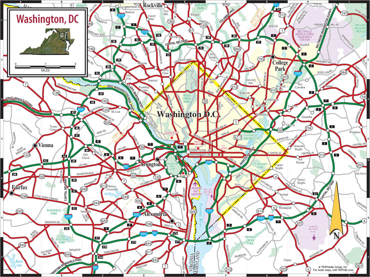
The Washington DC roads map shows all road network and highways of Washington DC. This roads map of Washington DC will allow you to find your routes through the roads and motorways of Washington DC in USA. The Washington DC roads map is downloadable in PDF, printable and free.
There are 1,500 miles (2,400 km) of public roads in Washington DC, of which 1,392 miles (2,240 km) are owned and maintained by the District government as its mentioned in Washington DC roads map. All Washington DC road names include the quadrant abbreviation to indicate their location, and house numbers are assigned based on the approximate number of blocks away from the Capitol.
Washington DC road or interstate 495, also known as the "Capital Beltway", creates an artificial boundary for the inner suburbs of Washington DC and is the root of the phrase "inside the Beltway" as you can see in Washington DC roads map. A convergence indexing based road traffic monitoring system was installed on Washington highways in 2008.
Among the major roads in Washington DC are MacArthur Boulevard NW, 14th Street NW, 16th Street NW, 18th Street NW, 7th Street NW, Connecticut Avenue NW, K Street NW, H Street NW, Wisconsin Avenue, M Street NW, H Street NE, Pennsylvania Avenue, Constitution Avenue, Independence Avenue, Massachusetts Avenue, U Street NW, South Dakota Ave NE, North Capitol Street, South Capitol Street, East Capitol Street, Georgia Avenue, Minnesota Avenue, Benning Road, Martin Luther King, Jr. Avenue, New York Avenue, and Rhode Island Avenue as you can see in Washington DC roads map.