

You can find on this page the Washington DC bike map to print and to download in PDF. The Washington DC bicycle map presents the bike routes and lanes of Washington DC in USA.
The Washington DC bike lane map shows all the bike routes of Washington DC. This bicycles lanes map of Washington DC will allow you to easily plan your routes with a bike in Washington DC in USA. The Washington DC bike lanes map is downloadable in PDF, printable and free.
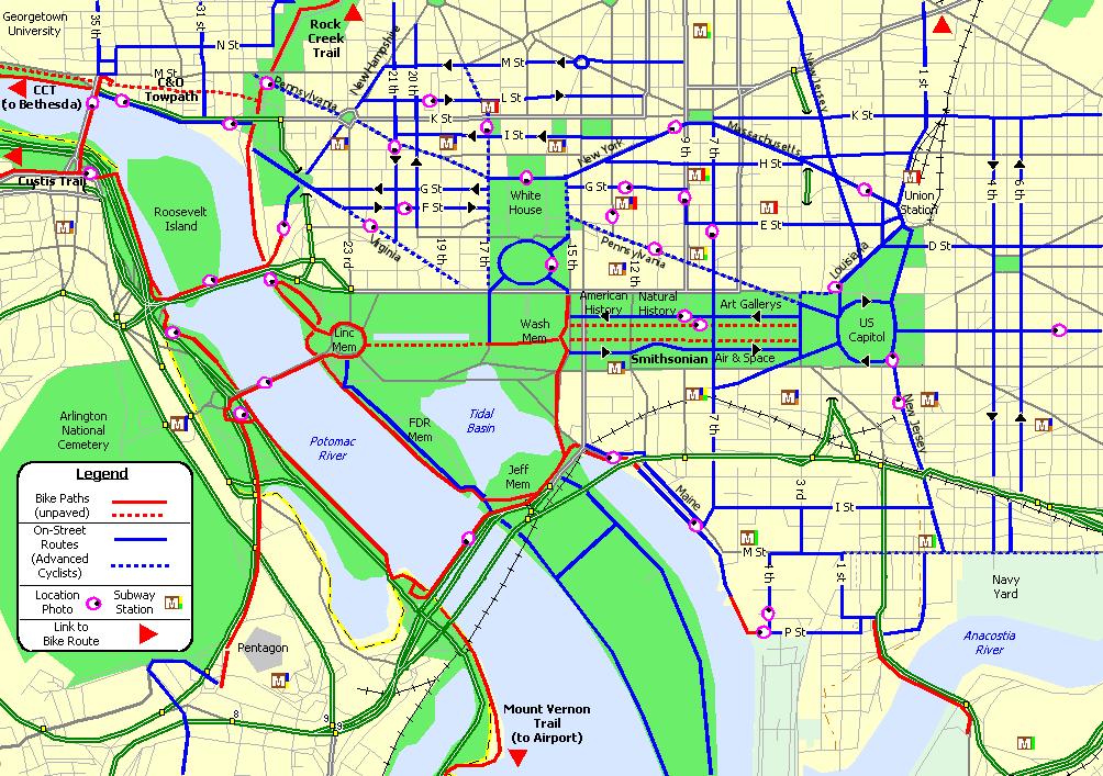
Marked bike lanes in Washington DC currently exist on 48 miles (77 km) of streets and the city plans to further expand the network. There is a network of 45 miles (72 km) dedicated bike lanes around Washington DC and there are 1,300 bike racks installed on sidewalks all over the city as its mentioned in Washington DC bike lane map. An estimated 3.3% of Washington DC residents biked to work in 2010, and by 2008 the city had the sixth-highest percentage of bike commuters in the United States.
DDOT Bike Lane program has built 89 miles of bike lanes in Washington DC since 2001. Beginning in 2009, the agency began installing protected bike lanes, also known as Cycle Tracks or separated bike lanes, and there are, as of 2019, 12 miles of these facilities as its shown in Washington DC bike lane map. A protected bike lane in Washington DC has some kind of physical separation between the motor vehicle travel and the bike lane.
Cyclists know that joy can be found outside. In Washington DC area, there are a wide variety of bike lanes that offer outdoor adventures—ranging from paved and easy to rocky and strenuous—for both serious and amateur cyclists. You can bike in and around Washington DC From the Mount Vernon Trail to the Capital Crescent Trail as its shown in Washington DC bike lane map.