

You can find on this page the Washington DC zipcodes map to print and to download in PDF. The Washington DC zip code map presents postal codes, address lookup and code list of Washington DC in USA.

The Washington DC postcodes map shows all the zip codes of Washington DC. This zip code map of Washington DC will allow you to easily find postal codes and address lookup of Washington DC in USA. The Washington DC postcode map is downloadable in PDF, printable and free.
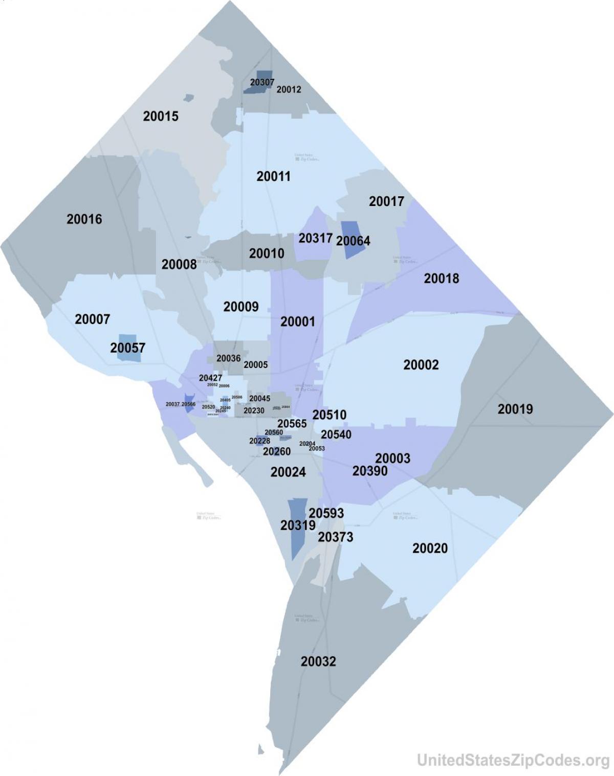
Washington DC is the actual or alternate city name associated with 270 ZIP Codes by the US Postal Service as its mentioned in Washington DC postcodes map. The Residential addresses are segmented by both Single and Multi-family addessses. Each individual Washington DC postcode profile also includes Demographic Data including Population, Housing, Income, Households, and Growth Rates.
There are multiple postcodes here in Washington DC. The Washington DC postcodes range from 20001–20098 - then come a whole slew of other higher numbers for individual Federal buildings - like 20500 for the White House as you can see in Washington DC postcodes map - OR like 22202 for the Pentagon - which is not even in DC - it is in Virginia.
Below is an interactive Washington DC postcodes map. Here are all of the Washington DC postcodes in the district of Columbia and the city/neighborhood in which the postcode is in: 20001, 20002, 20003, 20004, 20005, 20007, 20008, 20009, 20010, 20011, 20012, 20015, 20016, 20017, 20018, 20019, 20020, 20024, 20032, 20036, 20037, 20057, and 20064 as its shown in Washington DC postcodes map.